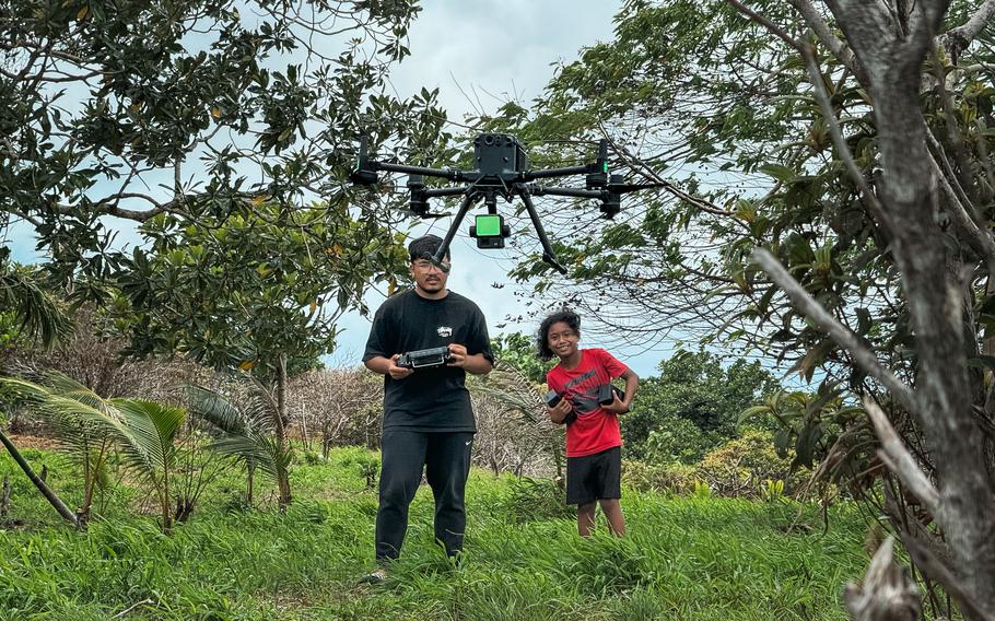
Thomas Torres II operates a DJI M350 RTK equipped with a LiDAR sensor during a mapping mission in Aimeliik, Palau. (Photo courtesy of 2cofly)
Thomas Torres II, a professional intern with the NASA Guam Space Grant program at the University of Guam and a member of the University of Guam Drone Corps, recently played a crucial role in a groundbreaking two-week mission to map ancient man-made terraces in Palau. As part of his internship with 2cofly, a local drone service provider, Torres and the team utilized drones and advanced LiDAR (Light Detection and Ranging) technology to uncover these hidden historical sites.
The mission, led by resident archaeologist Dr. Jolie Liston and funded by the U.S. Ambassadors Fund for Cultural Preservation, aimed to map around 3,000 acres of ancient terraces in the state of Aimeliik, providing detailed data about these historical cultivation sites. Drone surveys of the terraces, which have been covered by thick tropical vegetation over the past thousands of years, will help researchers better understand these landforms’ significance as they relate to Palau’s historical culture, infrastructure, agriculture, defense systems, ceremonies, and rituals.
“The objective of the project is to increase the cultural, social, and economic value of Palau’s monumental earthwork landscape to preserve the legacy of this significant cultural heritage for future generations,” Liston said. “This goal will be accomplished through an integrated approach combining remote sensing, archaeological field work, and oral history collection, all of which include education and capacity-building components.”
The use of drones equipped with LiDAR sensors allow laser pulses to penetrate the vegetation to reveal the ancient topography underneath. Compared to past plane-based surveys, the drone and LiDAR technology combination offers several advantages, including the ability to survey large areas and to sense beneath dense vegetation with higher efficiency and accuracy.
The collected data was processed to create detailed 3D models of the terraces and a high-resolution digital terrain model (DTM). These models reveal the structure and extent of the terraces with unprecedented clarity, offering significant benefits for archaeological research and conservation efforts.
Despite initial challenges with the weather, technology, and terrain, Torres found the campaign incredibly fulfilling.
“Learning about the forgotten history of the terraces was incredibly intriguing, especially since most people wouldn’t think much about them,” he said. “It was astonishing that there are no oral accounts of them, despite Palau’s deep roots in oral history.”
Torres, who attends Guam Community College as a civil engineering technology student, credits the University of Guam Drone Corps and NASA Guam Space Grant programs for preparing him with essential skills in drone operation, safety precautions, and fieldwork.
“Participating in cohort three of the Drone Corps program helped me learn the necessary skills to confidently handle a drone,” he said. “Through the NASA Guam Space Grant internship program, I was able to intern with 2cofly and be a part of many missions on Guam.”
Through their efforts with Liston’s project, Torres and the 2cofly team aim to not only highlight the island’s ancient terraces, but also inspire future generations to value and protect their historical environments. The detailed data from this mission is expected to be shared with major publications, bringing global attention to Palau’s remarkable environment and encouraging further archaeological research and preservation efforts.
The UOG Drone Corps is accepting internship applications for the Fanuchånan 2024 semester until Aug. 2, 2024. In addition to the Professional Internship Pathway, the program also offers Research and Teaching Internships. Participants receive a stipend totaling $3,000 per semester with an opportunity to extend into a second semester for a total of $6,000 per academic year. Interested applicants can apply at bit.ly/ngsg2024 or reach out to Keanno Fausto at faustok9679@triton.uog.edu.
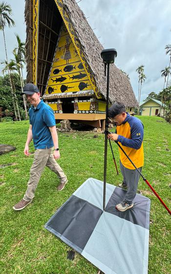
Thomas Torres II sets up an RTK base station during the LiDAR mapping campaign in Palau. (Photo courtesy of 2cofly)
A DJI M350 RTKdrone equipped with a LiDAR sensor flies over Aimeliik state. (Photo courtesy of 2cofly)
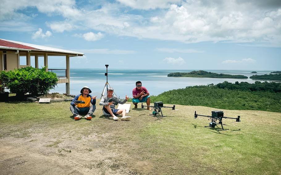
The mapping team poses with their fleet of DJI M350 RTK drones equipped with LiDAR sensors in Aimeliik, Palau. (Photo courtesy of 2cofly)
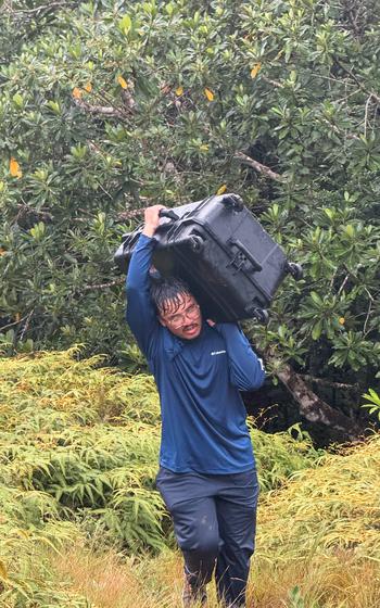
Thomas Torres II hauls a drone case in rainy weather during a mapping mission in Aimeliik, Palau. (Photo courtesy of 2cofly)
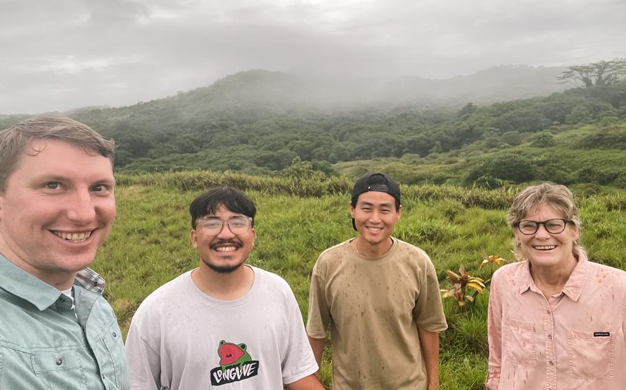
The campaign team takes a group photo during a mapping mission in Aimeliik, Palau. (L-R: Anthony Herman, Thomas Torres II, Dong Won Lee, Jolie Liston) (Photo courtesy of 2cofly)

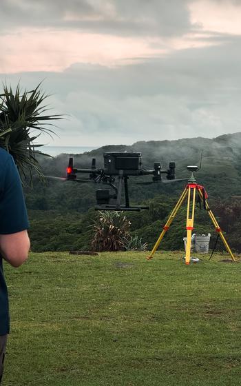
DJI M350 RTK drone hovers over Aimeliik state. (Photo courtesy of 2cofly)
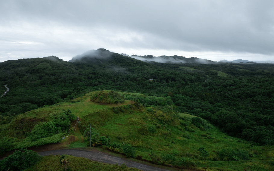
Aerial imagery of one of the many terraces in Aimeliik, Palau. (Photo courtesy of 2cofly)
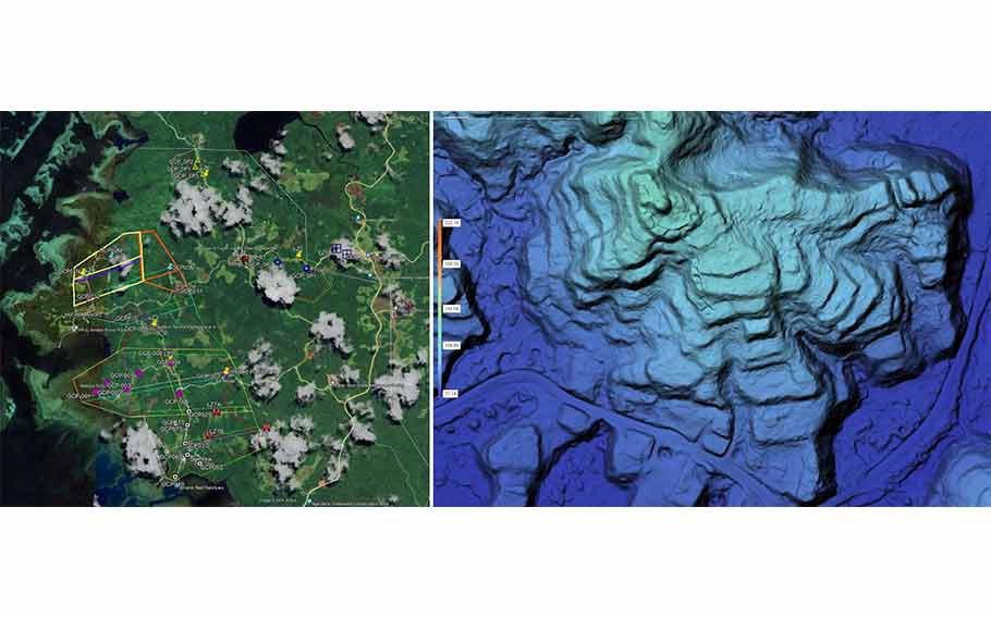
Left image: Flight planning using Google Earth software. Right image: One of the many processed areas using DJI Terra software. (Photo courtesy of 2cofly)
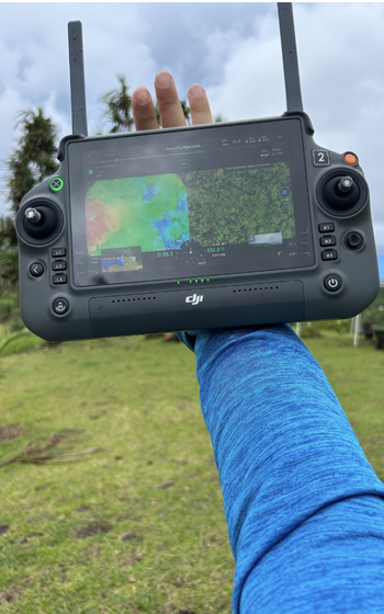
A DJI drone remote controller displaying a side-by-side comparison of the LiDAR data and the RGB imagery of a terrace in Ameliik, Palau. (Photo courtesy of 2cofly)