()
Editor’s note: Guam’s beauty is steeped in history. So get out and explore the island and educate yourself on why things look the way they do. And when you do, tell us about it and we’ll post it on this site and run it in our weekly community newspaper Stripes Guam. You can file your story on this site or send it to Guam@Stripes.com.
Ritidian
There were thriving villages in Ritidian, on the northwest coast of Guam, 600 years before the arrival of the Spanish. A 3,300 year-old fishing camp was discovered at Ritidian. Ritidian now preserves 371 acres of coral reefs and 832 acres of terrestrial habitats. Red, white, and black drawings in caves have been found in the caves here.
Pagat
Pagat is one of four recorded latte sites on the northeastern side of Guam. The archaeological site contains remnants of a large latte village. Local healers still come to the area tadvice from the spirits and gather herbs and plants for medicine. Teachers often take students there for field trips. The site continues to be a good archaeological resource as well.
Pago
According to a Chamorro legend, Pago Bay was formed by a giant fish that ate the center part of the island. Eventually the giant fish was caught by a group of Chamorro women who captured it with a net woven from their hair.
Recently archeologists discovered artifacts indicating that people lived on the shores of Pago Bay before the Spanish arrived. Latte Era artifacts were recovered that include pottery fragments and shell ornaments. There was a village at Pago Bay during the Spanish Era (1668-1898) until most of Pago’s population was killed in a small pox epidemic in 1856.
Talofofo
The interior lands of Talofofo are believed to have been occupied since 364 AD (1,700 years ago). There are numerous latte sites in the area and other remains of human habitation such as stone tools, slingstones and pottery sherds.
A group of islanders from the Caroline Islands arrived at Talofofo Bay, Guam in 1788 on a mission to get iron. A 135-foot bridge was built in 1931 over Talofofo river. Talofofo bay was one of the landing points for Japanese forces in WWII. Talofofo was considered part of Inarajan during the US Naval Era of Guam (1898-1941).
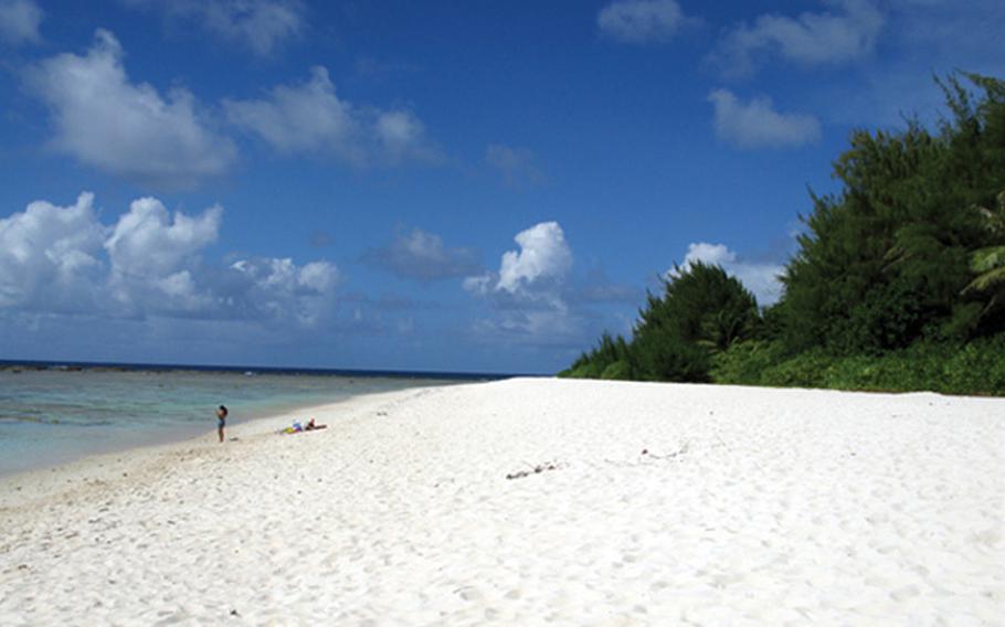
Tarague
Tarague, located at the northern shore of Guam, provided an excellent locale for ancient Chamorros with its coastal plain, cliffline, lagoon, coral reef and open sea providing a rich habitat for a variety of life. People lived at Tarague from the earliest time that Guam was settled, some 3,700 years ago.
There was a thriving village of Chamorros at Tarague during the Spanish Era (1668-1898) located on the coastal plain near the Tarague Channel. A Spanish church was constructed there, noted in an 1819 report, though no trace of it has been found to date. There are pictographs inside a limestone cave in Tarague discovered in the 1920s. During the US Naval Period of Guam history (1898-1941) much of the land at Tarague was used for copra production. Atkins Kroll (AK) operated a copra plantation there from 1918 to 1930. By 1930, the price and demand for copra had dropped and it was no longer profitable for AK to continue its copra business in northern Guam.
During the brief period of Japanese occupation of Guam (1941-1944) Tarague was of both military and civilian significance. A Japanese regiment was stationed at Tarague. Ships were ordered to head to Guam from Saipan and land at Tarague Beach during the battle to take Guam by the US.
After World War II Tarague was taken by the US military and is now a part of Andersen Air Force Base, named in honor of Brigadier General James Roy Andersen (1904-1945).
Fena
Rock shelters in Fena Valley, located off Cross Island Road in central Guam, were used by Chamorros some 2,000 years ago. Some of the cave walls are still covered with cave art (petroglyphs).
The Fena wetlands in central Guam are home to a variety of plants and animals. These wetlands have the largest population of common moorhens on island, and were at one time essential habitat for the Marianas Fruitbat (fanihi).
There is a herd of feral water buffalo (carabao) at Fena that have trampled and overgrazed some of the land and caused erosion. Pigs (babui), deer (binadu), brown treesnakes and other creatures inhabit some of the more forested regions of the valley. There is very little non-military activity in Fena Valley because of the safety zone required for the ordnance stored there.
Toward the end of the Japanese occupation of the island during World War II, Fena Valley, in central Guam, became the site of one of the most horrific massacres in Guam history when more than 30 young men and women were tortured and killed in the caves. Just before the arrival of American forces in July 1944, nearly 200 people from Agat and Sumay were forced into labor for the Japanese, who set up sleeping areas in the open grasslands and rock shelters of Fena. The atrocities by Japanese soldiers included rapes, beatings and massacres of Chamorros prior to the American bombardment of Guam.
Manenggon
In the Spanish Era of Guam history (1668-1898) the Manenggon Hills area was used to graze cattle. Farmers kept ranches in the area but no village existed there. Manenggon valley was used as a site for a large concentration camp in World War II in 1944. The Manenggon camp was the largest concentration camp and was occupied by as many as 15,000 people. After World War II the US military opened up a refugee camp in Manenggon. Many Chamorros stayed there before returning to their farms after the war was officially over.
Haputo
Early historic accounts from the Spanish Era (1668-1898) mention that the village of Haputo (sometimes spelled Apoto) was burned in 1678 by Spanish soldiers as the newly appointed Governor Captain Juan Antonio Ruíz de Salas tried to make his way to Tarague on the northeast coast to inflict punishment on the “rebellious” villagers there during the Spanish-Chamorro Wars.
Archeologists believe Haputo was occupied almost 2,000 years ago–ceramics from the area date in the range of 100 to 400 AD. An interesting feature of this area is a sinkhole that leads to a chambered cave with a fresh water pool. The walls of the chamber are slick limestone, but have impressions of hand and footholds to access the pool — the first observed case of such prehistoric construction to reach water.
Jati
There are remains of an ancient Chamorro village known at Jati at the north shore of Cetti Bay. The Jati site, on the southern west coast of Guam, contains two latte structures, each consisting of eight latte stones, all hidden from view by sword grass (sakati).