()
Etitor’s note: The U.S. territory of Guam is comprised of 19 villages, many with their own distinct character, history and points of interest. Stripes Guam and Guampedia have joined forces to present this weekly feature on each of them in the hopes that it will help our readers get out – and get to know – our gracious hosts. To learn more about Guam’s people, history, culture and places, visit: guampedia.com
The village of Asan probably derives its name from the word Hassan, which means scarce or rare in Chamorro. There are several theories of the origin of the name of the sub-community of Ma’ina, which comes from the Chamrro word ina (to illuminate or shine on).
Some of the variations on the village name’s origin are hunters in the area who hunted by the light of a torch and then saw their prey by the light of that torch; infants brought at sunrise to baptismal masses at which Catholics believe a person receives the “light” of God; and the moon that rises to illuminate the entire valley in which Ma’ina is situated.
Village history The village of Asan was predominantly a fishing village in pre-Spanish times that switched to farming with the settlement of the Spaniards. Villages grew taro, rice and sugar cane on the fertile flatland between the beach and the hills.
In 1892, Asan beach was the site of a Leper Colony, which was used for eight years until destroyed by a typhoon. Then in 1901 the area was turned into a prison camp for exiled Filipino insurrectionists, including Apolonario Mabini, a leader against the U.S. takeover of the Philippines, who is today considered a Philippine national hero.
In 1917, when the U.S. declared war on Germany, the enlisted men of the German cruiser SMS Cormoran, which had been docked in Apra Harbor for three years, were imprisoned at Asan Point by the naval authorities.
In 1922, Asan Point became a US Marine Corps camp with a quartermaster depot, a small arms range, and barracks, but the area, along with most of the island, was demilitarized in 1931.
During World War II, Asan beach played a vital part in the American recapture of Guam from the occupying Japanese forces. On July 21, 1944, the American invasion took place on the beaches of Asan and Agat, beginning with a bombardment of the island at 5:30 a.m. Japanese defensive positions were placed on top and on both sides of Asan and Adelup points. The United States Armed Forces had four battleships, three cruisers, and three destroyers just off of Asan. Then at 7 a.m. transports moved toward shore in Asan to unload 180 armored landing vehicles full of assault troops. Lead Marines crossed the reef from 200-500 yards offshore and landed on Asan beach, which was defended by Japanese infantry and naval troops manning coastal defense guns.
Nine Marine battalions landed at four points along the coast, assaulted the beaches, took Orote Peninsula, the land behind Asan and Libugon Hill (which was renamed after Nimitz following the war). Fighting lasted several days, with desperate Japanese soldiers making last-ditch “banzai” suicide charges at the Marines. The Asan area was secured on July 28 but it took until August 10, 1944 to eliminate all organized resistance on the rest of Guam.
After World War II ended, Asan Beach became known as Camp Asan until 1947. Camp Asan was used as headquarters and barracks for the U.S. Navy Seabees who helped to reconstruct the island. The village of Asan was relocated further inland along the bottom of the hillside. Maina was also added as part of the municipality.
From 1948-1967 Camp Asan became the “Civil Service Camp.” In essence, it was a small military base with housing, an outdoor theater, tennis courts and a fire station. In 1968 the Navy converted the buildings into a hospital annex for use during the Vietnam War. This was utilized for seven years until the area was turned into Vietnamese Refugee Camp in 1975. There were a total of 111,000 Vietnamese refugees who came through Guam after the Fall of Saigon. In 1976 Supertyphoon Pamela destroyed all of the remaining buildings at Asan beach and the area was cleared of the debris by the Navy. The National Park Service acquired the area in 1978 and the War in the Pacific National Historical Park was established.
POINTS OF INTEREST
Historical
Asan Beach Unit, War in the Pacific National Historical Park The Asan Beach Unit is the site of the American northern landing beach in World War II. War-related structures are located at Asan Point, including two Japanese gun emplacements. The remains of some American military equipment and coral-encrusted ordnance lie underwater in the offshore area. A “Liberators’ Memorial,” installed at Camp Asan, during the 50th anniversary ceremonies of the liberation of Guam, honors veterans of the armed forces who participated in the 1944 landing. Asan Bay Overlook on Nimitz Hill contains a memorial wall in honor of 16,142 Chamorros and Americans who died on Guam during the war years. Bronze panels illustrate scenes of the invasion, occupation and liberation of the island. The site provides a beautiful panoramic view of the Asan landing beach.
INSTITUTIONS
Church of Christ Church of Christ is a Christian Bible church located along Marine Corps Drive in the main village of Asan.
Niño Perdido Y Sagrada Familia (Holy Family Church) Asan’s Catholic church was established in 1947, just after World War II, and is the center of the main village. Like all other parishes, the village Catholic faithful honor their patron saint with an annual village fiesta.
Our Lady Of Purification Church Maina’s Catholic church was also established shortly after World War II in 1949. Like all other parishes, the village Catholic faithful honor their patron saint with an annual village fiesta. – Guampedia
Legend of the White Lady The Fonte River is the site of the local “White Lady” legend. According to the legend, a beautiful young maiden died of a broken heart, waiting for her boyfriend to meet her at the bridge.
Another story centers around a grieving mother who also died there as she searched in vain for her child lost in the bamboo grove around the bridge. People driving over the bridge, especially late at night, have claimed to see the ghost of the “White Lady.” – Guampedia
This village at a glance
Population: As of the 2000 US Census, the population was 2,090, a number virtually unchanged from the previous census. As of November 2010, no official census numbers are available.
Village officials: The current mayor of Asan-Maina is Joana Margaret C. Blas who first came into office in 2013. (The first several mayors of the village were naval governor appointments, until residents were allowed the elect commissioners, and later mayors.) Vicente L. San Nicolas Commissioner/Mayor 1989-2012; Francisco A. Acfalle, Commissioner, 1985-1989; Daniel L. Guerrero, Commissioner, 1981-1984; Jose S. Quitugua, Commissioner, 1973-1981; Joaquin S. Santos, Commissioner, 1957-1973; Santiago A. Limtiaco, Commissioner, 1944-1957; Joaquin L. Jesus, Commissioner, 1938-1941; Santiago A. Limtiaco, Commissioner, 1931-1938; Santiago A. Limtiaco, Commissioner, 1930-; Enrique S. Cruz Commissioner, 1927; Felomeno San Nicolas, Deputy Commissioner, (no date given). (From Konsehelon Mahot Guåhan/the Mayor’s Council of Guam)
Village description: The district of Asan-Maina encompasses a large area, including the main coastal village of Asan, the community of Maina nestled in a valley between Nimitz Hill and Agana Heights, and most of Nimitz Hill (also known as Libugon) and land beyond it further inland.
The main village of Asan was redeveloped in the 1980s by the Guam Housing and Urban Renewal Authority (GHURA). The redevelopment changed the village’s look from its more traditional Spanish flavor to a fairly modern-looking suburban appearance. The streets were straightened, sidewalks were added and the houses are nearly all concrete with many two-stories high. GHURA still owns many of the houses in the main village, houses that were all built exactly alike, and even painted the same color. Space was limited by the ocean to the west and the hills to the east, which necessitated the two-story structures and small yards.
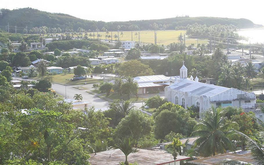
The village sits partly on the hillside of Nimitz Hill and partly on the flat land below it, just in front of the sea. Many of the houses are built on steep roads going up the hillside, reminiscent of San Francisco. The Catholic church, Niño Perdido Y Sagrada Familia (Holy Family), sits at the center of the village, along with the community center and mayor’s office.
Asan’s most distinguishable landmark is a large grassy park that sits between the main village and the ocean. Known by many as Asan Beach Park, the Asan Beach Unit of the War in the Pacific National Historical Park is a large expanse of grass, with coconut trees, pavilions, a popular walking path, the Liberator’s Memorial and historical artifacts commemorating the battle that took place in Asan at the end of World War II.
A separate part of the park is located on Nimitz Hill, called the Asan Bay Overlook, which contains a memorial wall of those who died on Guam during WWII, along with a lookout area with a panoramic view of the area in which the Asan battle took place.
Nimitz Hill, named for US Navy Admiral Chester Nimitz, is also home to the former Naval headquarters, the Top of the Mar restaurant and a number of very expensive houses built there for the hill’s spectacular view. The navy’s top brass is also housed here.
Maina rests in a valley of lush vegetation, bamboo groves and colorful flowers that come right up to the houses and the main road. The small community is spread out along one small, winding main road, one end of which meets the road going up Nimitz Hill and twists its way to the back side of Agana Heights. The small Fonte Bridge at the end of the road is the site of the famous Guam legend of the “White Lady.”
The area surrounding the bridge is covered with lush vegetation including, giant trees and large leaves from plants and other vegetation fed by the nutrient rich soil near the river. The Fonte Dam (also known as Libugon Dam) was reportedly the first dam built on Guam. It was the main fresh water source for the majority of the island’s population that lived in Hagåtña before World War II.