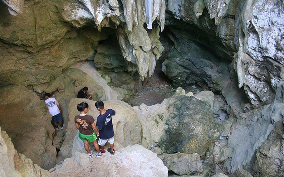
Local hikers enter one of the Talo’fo’fo Caves to explore and study artifacts such as lusongs, stone mortars, and pictographs, left by ancient Chamorros. (Photo by Nathalie Pereda, courtesy of Guampedia)
Editor’s note: The U.S. territory of Guam is comprised of 19 villages, many with their own distinct character, history and points of interest. Stripes Guam and Guampedia have joined forces to present this weekly feature on each of them in the hopes that it will help our readers get out – and get to know – our gracious hosts. To learn more about Guam’s people, history, culture and places, visit: guampedia.com
The village probably derives its name from the phrase “entalo’ i fe’fo’,” which means between the cliffs. It’s possible that the name is derived from another word, “fo’fo’,” which means a bubbling spring. As the Talofofo River and the Talofofo Falls are located in the village, the name could mean “between the bubbling springs.”
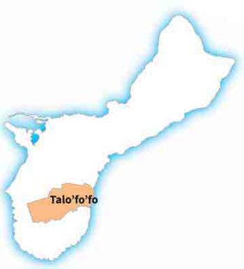
(Talo’fo’fo map)
Village history
The original pre-Spanish inhabitants of Talofofo lived mostly in settlements along the Talofofo and Ugum rivers, although artifacts have been found in the Talofofo Caves, perhaps suggesting that people used the caves for shelter during typhoons.
In 1672, Spanish Jesuit priest Father Diego Luis de San Vitores ordered a church to be constructed at the Pigpug settlement near Talofofo Bay, and this church became the center of the new Christian community.
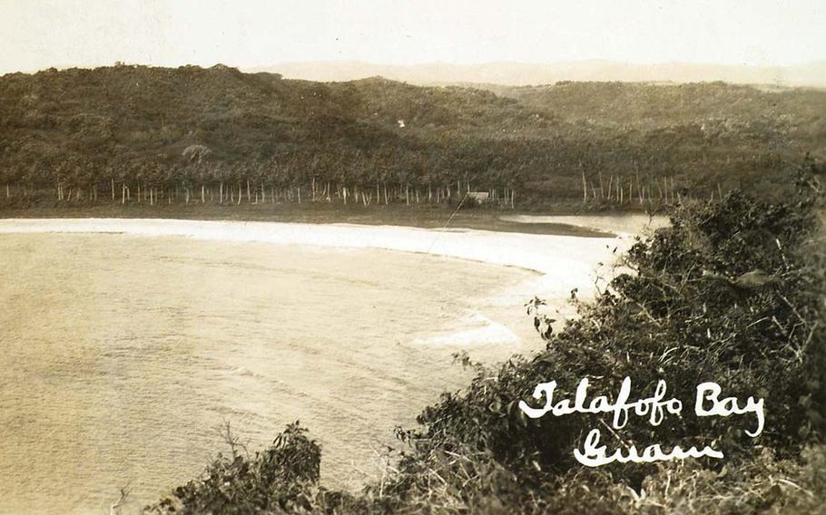
This historic photo shows Talo’fo’fo Bay where Carolinians landed during a 1788 voyage to trade for iron. This was the first such trade mission to Guam since the Chamorro-Spanish Wars, a century earlier. (Photo by Balthazar Aguon, courtesy of Guampedia)
The settlement never grew very large in size or prominence, although Talofofo Bay was the site of a few notable landings. One such landing was in 1788 of a large group of islanders from Lamotrek in the Caroline Islands, who arrived in canoes on a trading mission to obtain iron. It was the first such expedition since inter-island trade had come to a halt due to the Spanish-Chamorro Wars one hundred years before. The Spanish-Chamorro Wars were a series of rebellions by some of the Chamorros against Catholic indoctrination many years before.
After several months, the Carolinians departed for Lamotrek with iron and trade goods, but it later turned out that they never reached home and were probably hit by a storm. Don Luis de Torres, a Spanish-Chamorro military officer, travelled to Woleai in 1804 to reassure the Carolines that their peers had not died at the hands of the Spanish. Carolinians subsequently resumed their annual trading voyages to Guam.
Talofofo Bay was also the site of the eastern landing of Japanese forces during the invasion of Guam on December 10, 1941, when a detachment meant to land at Ylig Bay in Yona mistakenly landed at Talofofo Bay instead. The detachment marched north to Hagåtña to meet the other landing forces.
In April and May of 1944, the American forces first started preparing for the invasion of the Marianas, including bombing raids over Guam and Saipan. On April 8, the submarine USS Seahorse torpedoed the 6,780-ton Japanese converted submarine tender Aratama Maru near the eastern coast of Guam, and the burning ship made it into Talofofo Bay, sinking three days later.
From August 1944 to September 1945, after the Americans recaptured Guam from the Japanese, the military government built the new community of Talofofo in the hills where it now stands.
In the northern part of Ipan, a Flight Personnel Rehabilitation Camp was built in 1945, with a beer garden, softball diamonds, volleyball courts, and horseshoe pitching pits. Later, a salt-water swimming pool was built. After providing for nearly 10,000 officers and soldiers, the camp was devastated in 1949 by Typhoon Allen.
In 1951, the San Miguel Church was constructed in the main village. While Talofofo had previously been a part of the municipality of Inarajan under the municipalities established in 1920 by the pre-war U.S. government, Talofofo soon became a municipality of its own after the war.
In 1972, two hunters from Talofofo, Jesus M. Duenas and Manuel Degracia, discovered and captured a Japanese soldier named Sgt. Shoichi Yokoi who had been living in the jungles of Guam for twenty-eight years. Yokoi’s incredible story quickly spread around the world. Instead of allowing himself to be captured by American forces in 1944, Yokoi and ten others hid in the hills of Talofofo.
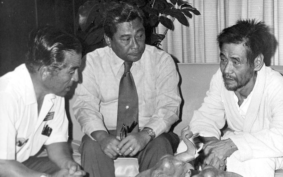
Governer Camacho and Sgt. Shoichi Yokoi. (Photo by Guampedia)
Yokoi was the only survivor, making clothing from the fibers of wild hibiscus plants and surviving on a diet of coconuts, breadfruit, papayas, snails, eels, and rats. He lived in a tunnel-like, underground cave in a bamboo grove not far from Talofofo Falls. After he was discovered, Yokoi became a celebrity, after nearly three decades of seclusion. He died in 1997 at the age of eighty-two.

This natural rock formation is called “Kissing Rock” by locals and offers hikers a spectacular view of the eastern coast of Guam, after ascending from Talo’fo’fo caves. (Photo by Nathalie Pereda, courtesy of Guampedia)
HISTORICAL
Talofofo Caves This series of caves on the side of the cliffs of the main village of Talofofo are famous for artifacts and pictographs of the ancient Chamorros.
RECREATIONAL
First Beach Island residents and visitors frequent this area that has about three large coral holes forming submerged natural pools in the waters of a beach located in Ipan just before the entrance to the main Talofofo village.
Ipan Beach Park This shaded beach area features several pavilions and barbecue pits, along with trees that keep beachgoers cool even on hot days.
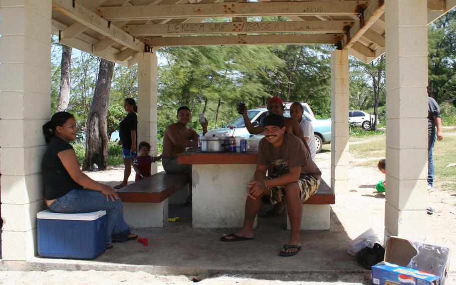
A family gathers under a pavilion in Ipan Beach Park to celebrate the beginning of summer. (Photo by Nathalie Pereda, Guampedia)
Ipan Beach Resort Located along Route 4, just past Ipan Beach Park, this privately owned resort offers residents a camping experience. There are several wooden bungalows for rent on the beachfront, a huge pool and restrooms with changing areas. Several local companies and organizations have reserved the space for private parties on the beach.

Kids frolic in the water and shore of Ipan Beach, a popular weekend area for families and friends. (Photo by Nathalie Pereda, courtesy of Guampedia)
Jeff’s Pirates Cove

Jeff’s Pirates Cove is a landmark on Guam, this popular establishment features a bar and grill with local food, a gift shop, a small museum, and recreational grounds that has been owned by Jeff Pleadwell since 1979. (Photo by Jen Crisostomo, courtesy of Guampedia)
Now a landmark on Guam, this popular establishment features a bar and grill with local food, a gift shop, a small museum, and recreational grounds that has been owned by Jeff Pleadwell since 1979. Numerous concerts have been held there, along with a semi-annual arts and crafts fair, weddings, and other parties. A previous owner was said to have found evidence of Malay pirates having stayed in the area, inspiring the Cove’s name, but in 1962 Typhoon Karen wiped out all traces of the Malay village, including a pirate ship scuba divers discovered in 1953.
Jungle Riverboat Cruise Scenic boat tours of Talofofo and Ugum Rivers goes to the ancient Talofofo Village, the site of a Chamorro hut and latte stones. Visitors to the site are treated to Chamorro cultural activities and demonstrations.
Onward Talofofo Golf Club Designed by nine U.S. professional golfers, this course offers spectacular views. It features a relatively flat front nine, with fairways lined by tropical trees, flowers, and water hazards. Hole 6 is designed as a replica of Talofofo Falls and is good for scenic photo opportunities. The back nine is more difficult but overlooks Guam’s tropical jungle and mountains.
Talofofo Falls Located along the Ugum River, on the boundary between Talofofo and Inarajan, the Talofofo Falls are accessed by a road in Malojloj, Inarajan. At the bottom of the two-tier falls are swimming holes popular among visitors. The falls have been turned into a tourist destination, with a paved road, visitor facilities, and an entrance fee. A replica of Sgt. Yokoi’s cave is nearby, as the original cave collapsed.
Points of interest
INSTITUTIONS
Notre Dame High School
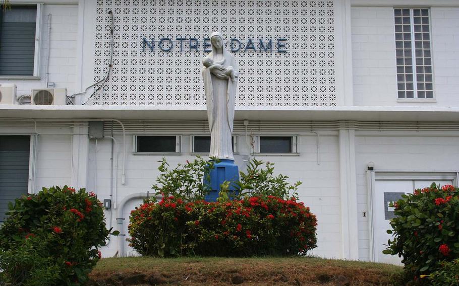
Notre Dame High School, Home of the Royals (Photo by Guampedia)
Nestled in the hillside of Talofofo village, Notre Dame High School established on Guam in 1968 by the School Sisters of Notre Dame, is one of three Catholic high schools on Guam, but the only co-educational facility.
Talofofo Elementary School Constructed in 1965, Talofofo Elementary School, remains the only public school servicing the elementary-aged children of this close-knit southern village.
This village at a glance
Population:As of the 2000 U.S. Census, the population was 3,245.
Village officials: Vicente S. Taitague, Mayor, 2009-present: Pedro D. Paulino, Mayor, 2005-2009; Anthony C. Leon Guerrero, Mayor, 2001-2005; Vicente S. Taitague, Mayor, 1997-2001; Tito A. Mantanona, Commissioner/Mayor, 1981-1997; Roman L.G. Quinata, Commissioner, 1969-1981; Juan C. Tenorio, Commissioner, 1961-1969; Jose P. Cruz, Commissioner, 1952-1961; Vicente Cepeda, Castro Commissioner, 1941-1944; Cayetano Aguon Quinata, Acting Commissioner, 1928-1929; Vicente Cepeda Castro, Commissioner, 1920-1928; Castro Aguon Deputy Commissioner/Acting Commissioner, 1939-1941; Vicente Cepeda Castro Deputy Commissioner, 1917-1920. (Courtesy of Konsehelon Mahot Guåhan/the Mayor’s Council of Guam). Note: Before World War II, the commissioners of Talofofo were appointed by the Naval governor. Starting in 1952, the commissioners and mayors were elected.
Village description: Former Mayor Tito Mantanona coined the name “God’s Country” for Talofofo, a nickname affectionately used by many residents and seen on signs throughout the village. At the heart of Talofofo is a four-way intersection recognized as the crossroads of this small village.
Anyone giving directions to a location in this village inevitably starts with this intersection, which is also at the heart of economic activity in Talofofo, with three corner stores doing business near the four-way intersection. North from the intersection is the village’s Catholic church, San Miguel Church, as well as the mayor’s office and houses, most of them similar to homes in suburban communities.
East from the intersection is the Onward Talofofo Golf Course, after which the road intersects with Route 17, locally known as Cross Island Road.
West from the intersection are more houses and Talofofo Elementary School, a sports field, and the Talofofo gym.
South of the intersection is the Seventh-day Adventist Church and Notre Dame High School, and as the road heads downhill toward the Talofofo subcommunity of Ipan and Talofofo Bay, it passes the ancient Talofofo Caves.
Sitting below the hills of the main village is the coastal community of Ipan, Talofofo. A number of secluded beaches and a scattering of houses, along with a gas station, make up most of Ipan. The area also includes Ipan Beach Park, a popular spot for barbecues. Jeff’s Pirates Cove is located on the northern border of Ipan and has become an institution in the area. It is best known for its relaxed-atmosphere bar and grill, along with a small souvenir store and an outdoor area used for arts and craft fairs, concerts and other gatherings.
The southern boundary of Talofofo is marked by the Ugum River (joined by the Talofofo River), which flows into Talofofo Bay. But as the Talofofo Bay park facilities are on the southern side of the bay, the area most people visit in Talofofo Bay is actually part of the neighboring village, Inarajan.