()
Editor’s note: The U.S. territory of Guam is comprised of 19 villages, many with their own distinct character, history and points of interest. Stripes Guam and Guampedia have joined forces to present this weekly feature on each of them in the hopes that it will help our readers get out – and get to know – our gracious hosts. To learn more about Guam’s people, history, culture and places, visit: guampedia.com
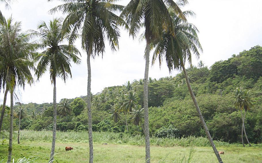
Yona derives its name from the Chamorro word iyo-ña, meaning to possess something material, personal or spiritual. One of the village’s long time landowners, Santiago Leon Guerrero Cruz, said many people admired the area for its bountiful coconut plantation, and visitors would frequently ask who owned the property. Residents of the area, which was then called As Misen, replied, “Iyo-ña, meaning they owned it. Now the area and village is known as Yona.
Village history
Yona’s history dates back to ancient times. Pulantat, one of the village’s 10 sections, was a prominent interior district before the Magellan arrived in 1521. Many latte stones and an ancient burial site have been discovered in this area. Another ancient burial site has been discovered about 100 feet north of Ylig Bridge along Route 4 along the Ylig Bay.
Latte were also discovered and destroyed during the development of Baza Gardens along Route 17. Tagachang Beach Park, along the coast, is also believed to have been the site of an ancient Chamorro village.
From ancient times until after World War II Yona was a rich farming area with fertile soil, good water, and abundant fishing grounds. People lived in scattered ranches. Only two buildings in the entire area were built of wood before the war with the rest being thatch. The village’s first public school was built in 1915.
Yona remained a relatively peaceful farming area during the war until the last few weeks of the Japanese occupation of Guam.
On July 12, 1944 the Japanese command ordered the relocation of people from their homes to camps in various parts of the island. The Japanese Imperial Army forces knew United States forces were approaching. Even the sick were forced to leave their homes and march from one concentration camp to another, until they reached the largest campsite in Yona’s Manenggon Valley.
During those last days of war, Manenggon Valley became home to about seventy-five percent of the island’s population which is about 18,000 people. People used the Manenggon River’s waters to wash themselves and their clothes and for cooking. They built shelters of wooden frames and coconut leaves.
Terrible rains came and flooded these temporary homes. As more people crowded into the two-square-mile valley, conditions worsened. Many people died of malnutrition and other illnesses.
Every day groups of men were taken from Manenggon to various worksites. Some were killed by the Japanese soldiers. Others will killed by U.S. air raids or from shells from naval vessels that were bombarding the island. Many victims were buried in the riverbanks. Some of the remains were later exhumed and given a proper burial.
After the war’s end, the Manenggon Valley camp was turned into a refugee camp where people were given medical attention and other assistance by U.S. forces and the American Red Cross. As people began to leave the area and return to their homes, Manenggon and other parts of Yona became home to the Third and Ninth Division Marines stationed there.
The village began to turn away from farming and toward urban development after the war. Then in 1962 Typhoon Karen hit Guam, leaving Yona with more destruction than any other village on the island. Ninety-five percent of all its buildings reportedly suffered damage.
The face of the village changed forever as an urban renewal project redesigned the village streets, restored damaged structures and erected new ones, creating many of the homes that stand today.
POINTS OF INTEREST
Historical
Tank Farm Although no battle actually occurred on this site, an area known as the Tank Farm is located near the Leo Palace Resort in Manneggon. The area is littered with rusted WWII-era tanks that were placed there for target practice as part of training U.S. military gunners.
RECREATIONAL
Tagachang Beach Park The coastal park is at the site of an ancient Chamorro settlement. An ironwood lined road winds its way to the park which is situated between the limestone cliffs of Yona and the fringe reef on the eastern side of Guam. It is a well-known fishing ground, though it is surrounded by strong currents outside the reef. The park offers a large pavilion for group events in addition to smaller pavilions.
Turtle Cove Turtle Cove is an inlet of Ylig Bay which was once the site of a sixty-unit A-frame campsite with water and recreational activities including fairs featuring craftsman and dancers from Guam and Micronesia by Kloppenburg Enterprises Inc in 1969. The complex was destroyed during Typhoon Pamela in 1976 but the Cove is still used as a picnic area.
Hamamoto Tropical Fruit World The tropical fruit haven, located along Route 17, also known as Cross Island Road, combines agriculture with tourism. It is an agroforestry project with a mixture of existing forest interspersed with food trees.
Windward Hills Country Club Renamed from Takayama Golf Club in 1995, this 18-hole public golf course was designed in 1951 and is the oldest public course on Guam.
Country Club of the Pacific This golf course is in Ipan, along the ocean, built in the 1970s.
LeoPalace Resort This resort, located in Manenggon Hills in the interior of Yona, offers plush accommodations for visiting hotel guests and live in condominium residents. It also has a man-made lake, convenience store, sports fields, swimming pools, restaurants and a bowling alley. It offers golf enthusiasts the private LeoPalace Resort Country Club featuring a 36-hole golf course made up of three 4-hole courses. The golf courses were designed by American golf legends Arnold Palmer and Jack Nicklaus.
INSTITUTIONS
Church of St. Francis of Assisi Residents have rebuilt this Catholic church twice after it was damaged by a 1936 earthquake and again during the WWII bombardment. Village residents redesigned and rebuilt the present day mission-style church and rededicated it in 1954.
Guam Adventist Academy This co-educational private school offering education from pre-school through the twelfth grade. The school first opened in 1949 with a campus in Dededo. A second campus opened in Talofofo. The Dededo campus began to expand and then transferred to Agana Heights. Damage caused by Typhoon Karen led to the rebuilding of facilities in the Windward Hills area of Yona where the school continues to operate today.
M.U. Lujan Elementary School Established in 1971, the Yona elementary school, which is part of the Guam Public School System, was renamed the Manuel U. Lujan Elementary School in 1975. Lujan was a teacher and the principal of the Yona elementary School. His wife, Mariana, was also a teacher at the school.
Redemptoris Mater Seminary The Archdiocesan Missionary Seminary is under the Archdiocese of Agana. The name is Latin for “Mother of the Redeemer.” The seminary was erected on December 8, 1999, by Archbishop Anthony S. Apuron, OFM Cap., DD, for the purpose of training future priests for missionary work in the New Evangelization called for by the late Pope John Paul II.
St. Francis Catholic School This Catholic school opened in September 1949 with an enrollment of 301 students. The school was established by the first seven School Sisters of Notre Dame on Guam. Plans to establish a high school were in place, but the devastation caused by Typhoon Karen in 1962 put the plan on hold. The school today educates students in kindergarten through the eighth grade. It is located in the heart of the village, just next to the church.
Know my island – Know my history
The village of Yona is the site of two concentration camps at the end of the Japanese occupation of WWII. During the twilight hour of the war, thousands of people from throughout Guam were herded into concentration camps in central and southern Guam.
The most infamous was the Manenggon Camp set up in the Manenggon Valley, located south of the main village along the Ylig and Manenggon Rivers. The other Yona concentration camp was in an area known as Asinan, located northwest of the main village between Lonfit and Pago rivers.
Though the majority of the people were marched towards Manenggon Valley by the Japanese during their occupation, hundreds of people were also diverted to Asinan.
This village at a glance
Population: According to the 2000 U.S. Census, there are approximately 6,484 people living in Yona. The population is now larger due to population growth and development.
Village officials: Ken Joe Ada, Mayor 2013-2017: Jose T. Terlaje, Mayor, 2001-2012: Vicente C. Bernardo, Commissioner/Mayor, 1973-2001; Jose B. Sudo, Commissioner, 1952-1973; Jose B. Eustaquio, Commissioner, (no dates provided); Jose Terlaje, Commissioner, (no dates provided); Jesus B. Cruz, Commissioner, (no dates provided); Ramon S. Baza, Commissioner, (no dates provided); Jose Sablan, Commissioner, (no dates provided). (Courtesy of Konsehelon Mahot Guåhan/the Mayor’s Council of Guam.)
Village description: Yona is the first southern village on the eastern side of Guam. Its boundaries stretch for six miles, from the south side of Pago Bay to the north side of the bridge at Jeff’s Pirates Cove in Ipan, Talofofo. The village also extends west on Route 17, or Cross Island Road, from Route 4, or Chalan Kanton Tasi, to Tarzan Falls, near the Naval Magazine overlook.
Its jurisdiction also includes the area from Pulantat and Manenggon Valley to Lonfit Bridge in Chalan Pago. As such, Yona is one of Guam’s largest municipalities in area and is divided into ten sections: Baza Gardens, Windward Hills, Ylig, Manenggon, Camp Witek, Pulantat, Triangle, Central Yona, Tagachang and As Namo.
A fiesta in honor of St. Francis of Assisi is celebrated the first weekend in October.